Mannar City
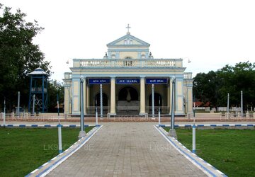
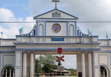
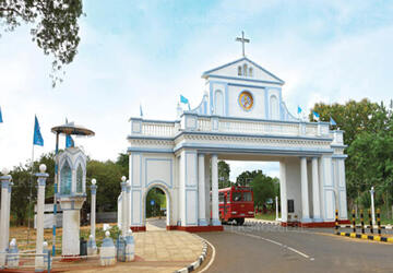
Mannar is the main town of Mannar District, Northern Province, Sri Lanka. It is governed by an Urban Council. The town is located on Mannar Island overlooking the Gulf of Mannar and is home to the historic Ketheeswaram temple.
マドゥ ගිලෙන්න
マドゥ (タミル語: மடு、シンハラ語: ගිලෙන්න) は、スリランカのマナール地区にある町です。ローマ カトリック教会の主要な巡礼地であるマドゥの聖母聖堂はこの町にあります。
マンル地区について
マナール地区はスリランカの北西部、北部州に位置します。マナールの面積は 1,996 平方キロメートル (771 平方マイル) で、マナール地区の主要な町です。それは都市評議会によって統治されています。この町はマナール湾を見下ろすマナー島に位置し、歴史的なケシースワラム寺院があります。かつてこの町は真珠漁の中心地として有名で、西暦 2 世紀のエリトラ海のペリプラスに記載されています。マナールはバオバブの木と、1560 年にポルトガル人によって建てられ、1658 年にオランダ人によって占領されて再建された砦で知られています。城壁と要塞は無傷ですが、内部は大部分が破壊されています。視覚的には、近代的な町は教会、ヒンズー教の寺院、モスクによって占められています。カトリック教会はこの町に本部を置く教区を持っています。鉄道では、町はマナーラインでスリランカの他の地域とつながっています。 1983 年から 2009 年までのスリランカ内戦中に LTTE によって占領されました。
北部州について
北部州はスリランカの 9 つの州のうちの 1 つで、国の第 1 レベルの行政区画です。州は 19 世紀から存在していましたが、スリランカ憲法修正第 13 条により州議会が設立された 1987 年までは法的地位はありませんでした。 1988 年から 2006 年にかけて、この州は一時的に東部州と合併し、北東部州が形成されました。州都はジャフナです。スリランカ内戦の大部分はこの州で行われました。
About Mannar District
Mannar is the capital of Mannar District, Sri Lanka. Mannar District is located in northwestern Sri Lanka. It is one of five administrative districts of the Northern Province. The district covers 2,002 sq. km, approximately 3% of the total land area of Sri Lanka. Geographically the bulk of Mannar is on the mainland within the arid and dry zone. High temperatures and low rainfall characterize the climate. The monthly temperatures range between 26.5°C and 30.0°C with highs normally recorded between May and August. Mannar receives nearly 60% of its rainfall during the northeast monsoon, which lasts from October through December. The land area is relatively flat and sits at low elevations. Towards the interior the terrain is gently undulating, favoring the storage of rainwater in tanks that provide the majority of the irrigation for the district's arable land. The primary economic activities in Mannar are crop cultivation (mainly paddy), fisheries and animal husbandry. Employment opportunities in the district are highly seasonal, and there are no institutional facilities for tertiary education.
About Northern Province
The Northern Province is one of the 9 provinces of Sri Lanka. The provinces have existed since the 19th century but they didn't have any legal status until 1987 when the 13th Amendment to the 1978 Constitution of Sri Lanka established provincial councils. Between 1988 and 2006 the province was temporarily merged with the Eastern Province to form the North-East Province. The capital of the province is Jaffna.
Northern Province is located in the north of Sri Lanka and is just 22 miles (35 km) from India. The province is surrounded by the Gulf of Mannar and Palk Bay to the west, Palk Strait to the north, the Bay of Bengal to the east, and the Eastern, North Central and North Western provinces to the south. The province has a number of lagoons, the largest being Jaffna Lagoon, Nanthi Kadal, Chundikkulam Lagoon, Vadamarachchi Lagoon, Uppu Aru Lagoon, Kokkilai lagoon, Nai Aru Lagoon, and Chalai Lagoon.Most of the islands around Sri Lanka are to be found to the west of the Northern Province. The largest islands are Kayts, Neduntivu, Karaitivu, Pungudutivu, and Mandativu.
The Northern Province's population was 1,311,776 in 2007. The majority of the populations are Sri Lankan Tamils, with a minority Sri Lankan Moor and Sinhalese population. Sri Lankan Tamil is the major language spoken in the province by the vast majority of the population. The other language spoken is Sinhala by 1 percent of the population. English is widely spoken and understood in the cities.
【Text by Lakpura™. Images by Google, copyright(s) reserved by original authors.】


