Badulla City
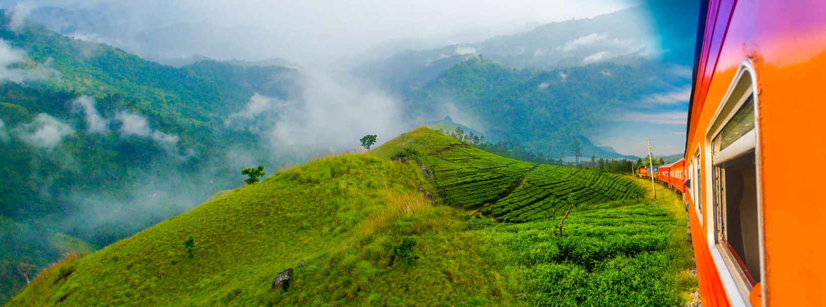
Badulla: Scenic town in Sri Lanka's hill country, surrounded by lush tea plantations and offering picturesque landscapes, waterfalls, and cultural sites.
バドゥラ
バドゥーラはスリランカのウバ州のバドゥラ地区にある都市です。バドゥラはキャンディの南東に位置し、ほぼ海抜680m(2,230フィート)のバドゥルオヤに囲まれており、茶畑に囲まれています。街はナムヌクラ山脈(最高峰は海抜2,016 m(6,614フィート)))に影を落としています。植民地時代以前のシンハラ人の王子(地方王)の本拠地であり、大英帝国の一部となる前にキャンディの主王の下でこの地域を統治していました。その後、イギリスの統治者の地方行政の中心地の1つになりました。この都市は、主に茶畑の産物をコロンボに運ぶためにイギリスが建設した内陸鉄道の終点でした。
バドゥラの茶園
Badullaはスリランカのお茶業界の主要企業です。バドゥーラの経済は緩やかで、プランテーション作物に大きく依存しています。これとは別に、ほとんどの農業は自給自足の多様性を持ち、産業はほとんどありません。世界的に有名なウバ地区は、他のお茶の産地とはまったく異なる地域です。シャンパンティーエリアです。Uvaは、非常に個性的で異なる品質の季節を経験します。Uva地域の工場では、CTC茶の品種だけでなく、全葉および小葉のグレードが風で生産されています。
バドゥラ地区について
バドゥーラはスリランカのウバ州の州都です。バドゥラはキャンディの南東に位置し、ほぼ海抜680メートル(2200フィート)のバドゥルオヤに囲まれており、茶畑に囲まれています。町はナムヌクラ山脈に覆われています。バドゥーラは、コロンボからスリランカの中央丘の東斜面に向かって約230kmの距離にあります。
ホートン・プレインズ国立公園とナックルズ山脈まで数時間で行けるので、バドゥラとその周辺はエコツーリストに強くお勧めします。
ウバ州について
ウバ州はスリランカで2番目に人口の少ない州で、人口は1,187,335人で、1896年に創設されました。バドゥラとモネラガラと呼ばれる2つの地区で構成され、州都はバドゥラです。ウバは東部、南部、中部の州に隣接しています。主な観光名所はダンヒンダ滝、ディヤルマ滝、ラワナ滝、ヤラ国立公園です(一部は南部と東部の州にあります)とガルオヤ国立公園(一部は東部州にあります)。ガル・オヤの丘と中央山脈が主要な高地で、マハウェリ川とメニク川、そして巨大なセナナヤケ・サムドラヤとマドゥル・オヤ貯水池があります。ウバ州の主要な水路です。
Special places in Badulla
-
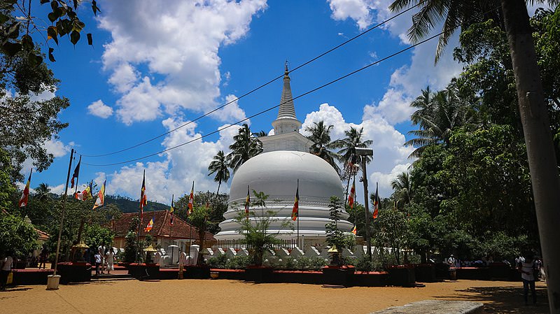
 Muthiyangana Raja Maha Vihara
Muthiyanganaya Raja Maha Viharaya lies in the centre of the city of Badulla. The History of this temple goes back to the time of Buddha but this area around Badulla goes way back in to the time of 19th -18th century BCE.
-
 Dowa Raja Maha Viharaya
Dowa Raja Maha Viharaya (Dowa Cape Temple) lies few kilometres away from the Bandarawela town on the Bandarawela – Badulla Road. This temple is thought to be done by King Walagamba in the in first century BC.
-
 Bogoda Wooden Bridge
The Bogoda Wooden Bridge was built in the 16th century during the Dambadeniya era. This is said to be the oldest surviving wooden bridge in Sri Lanka. The bridge is situated at 7 kilometres (4.3 mi) west of Badulla.
-
 Dunhinda Falls
Dunhinda Falls is situated about 5 km away from Badulla town. It is 63 meters high and is considered to be one of the most beautiful waterfalls in Sri Lanka. The falls gets its name dew to the smoky dew drops spray.
About Badulla District
Badulla is the capital of Uva Province in Sri Lanka. Badulla is located on the southeast of Kandy, almost encircled by the Badulu Oya , about 680 meters (2200 ft) above sea level and is surrounded by tea plantations. The town is overshadowed by the Namunukula range of mountains. Badulla is about 230km away from Colombo towards the eastern slopes of central hills of Sri Lanka.
Badulla and surroundings are highly recommended for eco-tourists as Horton Plains National Park and the Knuckles mountains are few hours away.
About Uva Province
The Uva Province is Sri Lanka's second least populated province, with 1,187,335 people, created in 1896. It consists of two districts called Badulla and Moneragala The provincial capital is Badulla. Uva is bordered by Eastern, Southern and Central provinces. Its major tourist attractions are Dunhinda Falls, Diyaluma Falls, Rawana Falls, the Yala National Park (lying partly in the Southern and Eastern Provinces) and Gal Oya National Park (lying partly in the Eastern Province). The Gal Oya hills and the Central Mountains are the main uplands, while the Mahaweli and Menik rivers and the huge Senanayake Samudraya and Maduru Oya Reservoirs are the major waterways in Uva province.
【Text by Lakpura™. Images by Google, copyright(s) reserved by original authors.】


