
Pasikuda City
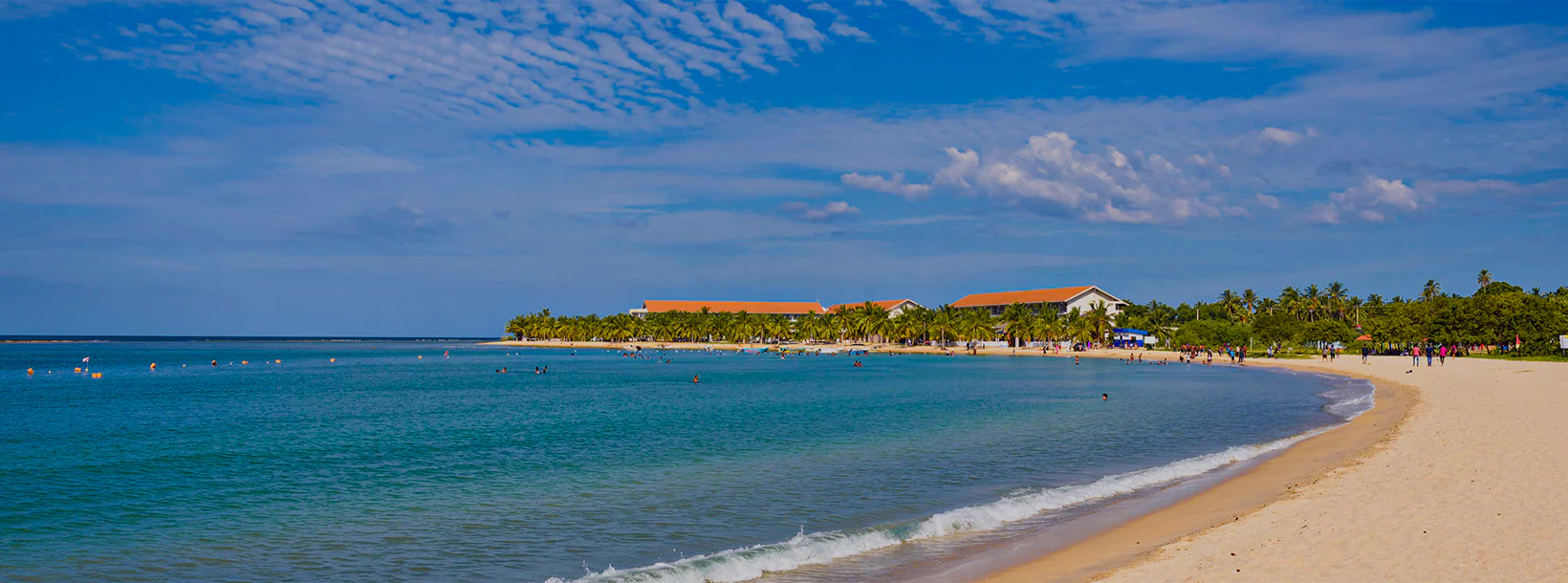
Discover Pasikuda's serene beauty on Sri Lanka's eastern coast. With its powdery white beaches and crystal-clear waters, Pasikuda is a tropical haven. Explore vibrant coral reefs, relish local delicacies, and unwind in tranquility. Experience paradise at its finest in Pasikuda.
パシクダ ビーチ
「緑藻の湾」を意味するパシクダは、カルクダとインド洋の間のスリランカ東海岸に位置し、バッティカロアの町から約 35 キロメートルです。湾のターコイズブルーの海は、熱帯の暑い太陽の下、サーフィンしたり、泳いだり、ただ水遊びをしたりするために、地元や外国人の観光客をこの広い砂浜に引き寄せます。カイトサーフィン、ブギーボード、サーフィン、カヌーでのセーリングなど、他にも多くのアクティビティをご利用いただけます。
スリランカ内戦のため長らく人が訪れることはできなかったが、現在はスリランカ東部の観光スポットとして再浮上している。この地域の海岸はココヤシやパルミラの木が生い茂っています。半乾燥状態のため、暑さを抑えるために、日焼け止めやつばの大きな帽子、そして水分をたっぷり摂取することをお勧めします。
About Batticaloa District
Batticaloais a city in the Eastern province of Sri Lanka.Batticaloa is in the eastern coast of Sri Lanka on a flat coastal plain boarded by the Indian Ocean in the east occupies the central part of the eastern Sri Lanka. Batticaloa is on the East coast, 314 km from Colombo. The population of 515,707 consists mainly of Tamils, Moors, Sinhalese, Euro-Asian Burghers (specifically Portuguese Burghers and Dutch Burghers) and indigenous Vedda population.
Rice and coconuts are the two staples of the district, and steamers trading round the island call regularly at the port. The lagoon is famous for its ""singing fish,"" supposed to be shell-fish which give forth musical notes. The district has a remnant of Veddahs or wild men of the wood.
The city has four main divisions.
Pullianthivu: Seat of many government department and offices, schools, banks religious places, General Hospital, Weber Stadium and Shops. Nowadays many NGO offices including ICRC, UN, UNICEF, WORLD VISION etc.are located also.
Koddamunai: Schools, Banks,Sri Lanka Telecom regional office for East, Shops and many government offices are located. Two bridges called Perya Palam and Puthuppalam are connect Pulianthivu Island with Koddaminai land mass.
Kallady: Here there are many Government buildings and private industries, schools, hospitals and Eastern University Medical Faculty. Kallady Lady Manning Bridge (the longest bridge in Sri Lanka connects Kallady and Arasay.
Puthur: This is where the dom
About Eastern Province
The Eastern Province is one of the 9 provinces of Sri Lanka. The provinces have existed since the 19th century but they didn't have any legal status until 1987 when the 13th Amendment to the 1978 Constitution of Sri Lanka established provincial councils. Between 1988 and 2006 the province was temporarily merged with the Northern Province to form the North-East Province. The capital of the province is Trincomalee. The Eastern province's population was 1,460,939 in 2007. The province is the most diverse in Sri Lanka, both ethnically and religiously.
Eastern province has an area of 9,996 square kilometers (3,859.5 sq mi).The province is surrounded by the Northern Province to the north, the Bay of Bengal to the east, the Southern Province to the south, and the Uva, Central and North Central provinces to the west. The province's coast is dominated by lagoons, the largest being Batticaloa lagoon, Kokkilai lagoon, Upaar Lagoon and Ullackalie Lagoon.


