Matale City
Matale, Sri Lanka, is renowned for its lush vegetation and spice gardens. Located in the central province, it offers a rich cultural experience with cooking classes and demonstrations. Visitors can learn traditional recipes and techniques, such as clay pot cooking, and enjoy dishes like chicken curry and dhal curry, making Matale a culinary and cultural treasure.
バンバラキリ エラ フォールズ
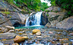
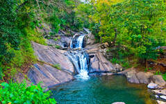
この壮大な滝は、マータレー地区のラトータの町の近くにあります。マータレ - イルクンブラ道路をバマラキリ滝の曲がり角まで進み、ラトータの町を 1 km 過ぎたところに滝があります。バンバラキリ滝はマータレーの町から 18 km です。バンバラキリ滝は、スリランカで最も人気のあるハネムーン向けホテルの 1 つであるアマヤ フナス滝から約 40 km 離れたところにあります。
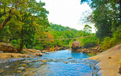
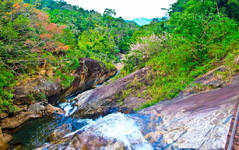
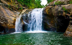
秋はナックルズ山脈の魅惑的な緑の中にあります。バンバラキリエラは10mの落差です。秋は3つの部分に分けて見ることができます。さまざまな種類の蝶や鳥が滝付近に飛来するのは主に晴れた午前中で、その眺めがさらに魅力的になります。
非常に昔ながらの吊り橋が滝の上に伸びており、すでに美しい景色に魅惑的なタッチを加えています。
大量の水が高速で地上に衝突します。滝のふもとにある岩のプールは、乾燥した夏の間は安全に泳ぐことができますが、大雨の季節には非常に危険になる可能性があります。
もっと冒険したい人には、滝の頂上に到達するための 5 km の滑りやすい急な登りがあります。ただし、ちょっとしたミスが大怪我に繋がることを念頭に置いておかなければなりません。
登山は簡単ではないので注意が必要ですが、頂上からの景色は息をのむほどです。さらに、頑張って登った人には、水浴びに最適な冷たくて透き通った天然の岩のプールという素晴らしい特典もあります。
この静かで平和な場所は、まさにマータレーの隠れた宝石です。休暇でマータレーの地域を訪れる旅行者は、この美しい場所を訪れることを強くお勧めします。
バンバラキリ エラへの行き方
バンバラキリ滝は、マータレ - パレガラ - ハサラカ山道の曲がり角から約 200 m 離れたところにあり、ラットタの町からはほぼ 5 km の上り坂にあります。マータレー市からの距離は約 16 km です。
マータレーまたはキャンディ行きの専用タクシーを予約し、最後にラトータの町に向かい、そこから秋に向かう自然遊歩道を歩くこともできます。
マータレーやキャンディ行きの公共交通機関も利用できます。
About Central Province
The Central Province of Sri Lanka consists primarily of mountainous terrain. The province has an area of 5,674 km², and a population of 2,421,148. Some major towns include Kandy, Gampola (24,730), Nuwara Eliya and Bandarawela. The population is a mixture of Sinhalese, Tamil and the Moors.
Both the hill capital Kandy and the city of Nuwara Eliya are located within the Central Province as well as Sri Pada. The province produces much of the famous Ceylon tea, planted by the British in the 1860s after a devastating disease killed all the coffee plantations in the province. Central Province attracts many tourists, with hill station towns such as Kandy, Gampola, Hatton and Nuwara Eliya. Temple tooth or Dalada maligawa is the main sacred place in Centrel province.
The climate is cool, and many areas about 1500 meters often have chilly nights. The western slopes are very wet, some places having almost 7000 mm of rain per year. The eastern slopes are parts of the mid-dry zone as it is receiving rain only from North-Eastern monsoon. The Temperatures range from 24°C at Kandy to just 16°C in Nuwara Eliya, which is located 1,889 m above sea level. The highest mountains in Sri Lanka are located in the Central Province. The terrain is mostly mountainous, with deep valleys cutting into it. The two main mountain regions are the central massif and the Knuckles range to the east of Kandy.


